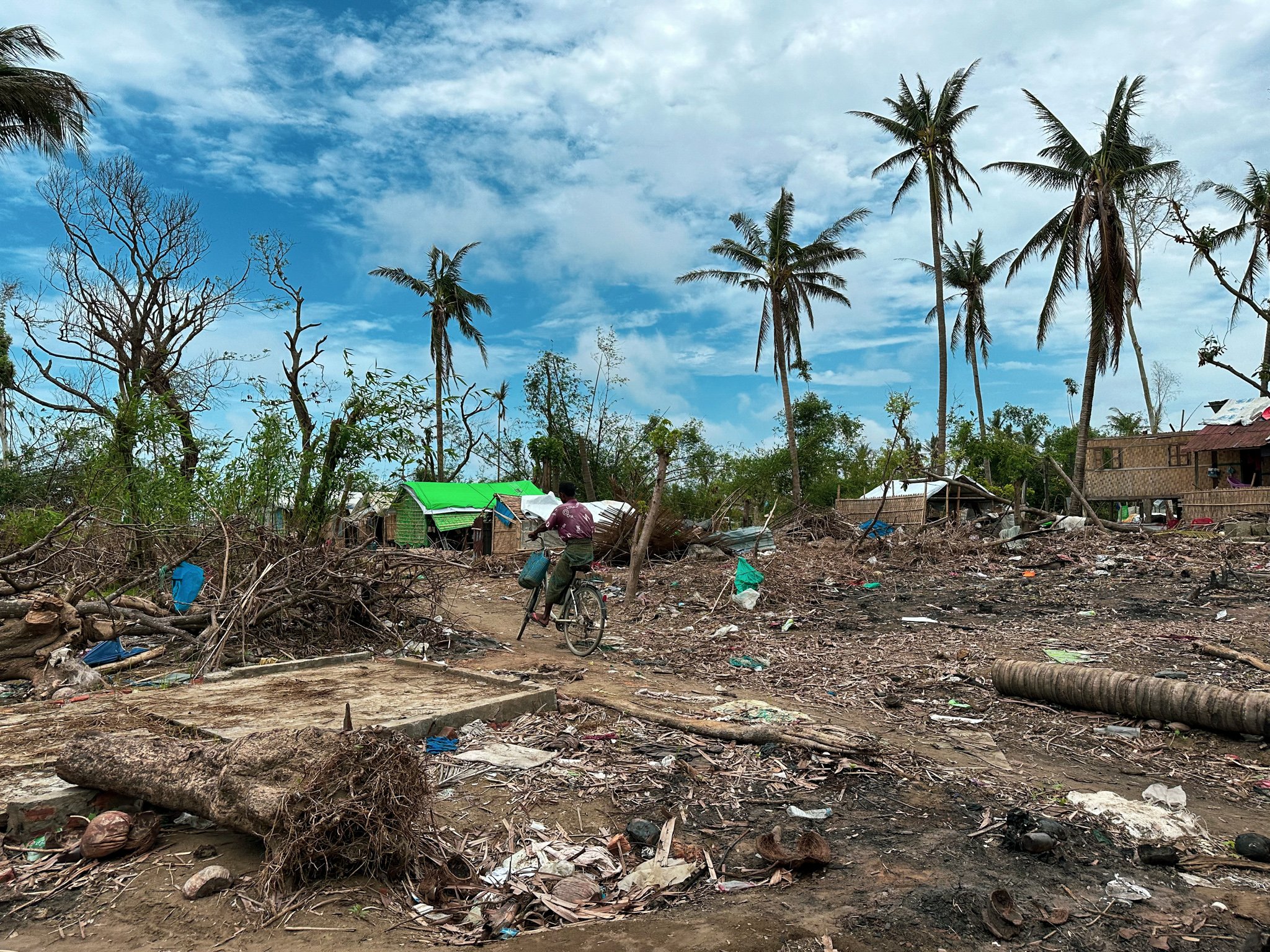
The impact of Cyclone Mocha on Dar Paing village. © UNHCR/Reuben Lim Wende
By Andrea Pellandra and Geraldine Henningsen
Forced displacement is a pressing global challenge that has become increasingly complex in recent years. The number of forcibly displaced persons as a result of persecution, conflict, violence, and human rights violations surpassed 108 million worldwide at the end of 2022. Moreover, as the world grapples with the devastating impacts of climate change, climatic slow-onset hazards such as drought, sea-level rise, and other weather-related disasters are emerging as a significant driver of forced displacement. According to the latest Groundswell report, it is estimated that by 2050, 216 million people will be forcibly displaced due to such hazards and disasters from slow-onset events.
The Key to a Timely Response: Data-Driven Anticipatory Action
Over the past few years, there has been growing recognition within the humanitarian sector of the need for data-driven anticipatory action.
This approach involves using data and analytics to identify and anticipate displacement risks before they occur, allowing humanitarian agencies to respond more effectively and efficiently to crises.
With the growing availability of data and technological advancements in remote sensing, data-driven anticipatory action is becoming an increasingly important tool in the humanitarian toolkit.
In 2022, UNHCR’s Global Data Service began to work on an early warning model to predict countries’ risk of significant displacement due to factors such as conflict, political instability, and economic downturn. This model is contributing to a wider effort within UNHCR to establish an early warning system for forced displacement as part of UNHCR’s anticipatory action plan.
However, anticipatory action is also critical in addressing climate-induced forced displacement. By prioritizing vulnerable groups, humanitarian agencies can ensure that those disproportionately affected by climate change receive the help they need on time. Furthermore, anticipatory action is crucial to prevent affected populations from becoming trapped in untenable and worsening environments.
Climate change does not discriminate
From rising sea levels threatening coastal communities to prolonged droughts and desertification devastating arid regions, slow-onset hazards spare no one. The most vulnerable groups, though, are often those living in poverty or areas with limited resources and infrastructure. Rural communities in low-income countries, reliant on natural resources for their livelihoods, face the risk of losing their produce as well as access to food markets and traders’ networks. Urban populations, too, are at risk, grappling with shortages of food, water, and resources due to disrupted supply chains and soaring food prices.
The consequences of slow-onset hazards are already being felt, with millions of people worldwide being affected. Unfortunately, this trend is only expected to worsen in the coming decades. Climate change has become a powerful catalyst for future displacement, directly and indirectly contributing to forced displacement.

Understanding Climate-Induced Forced Displacement
The question arises: Can a massive displacement flow be reliably predicted, and what variables primarily drive it? Understanding the link between climate change and forced displacement is complex and challenging to measure. The impact of climate change on poverty, political instability, and armed conflicts often mediates this connection.
To capture the multifaceted triggers of forced displacement, empirical studies reveal that a subnational approach is crucial, ideally at a grid level. This provides a more detailed and differentiated picture of the variables confined to specific areas and their interactions with varying local climates and environments. Subnational analyses are particularly valuable for understanding the indirect effects of climate hazards, such as conflicts arising from resource shortages. Moreover, this approach recognizes that the impact of rising temperatures will differ significantly between urban and rural populations, affecting diverse communities in distinct ways.
Forging a Path Towards Preparedness: The CLIFDEW-GRID Project
To gain a better understanding of the drivers of climate-induced forced displacement, UNHCR secured a two-year grant from the Complex Risk Analytics Fund (CRAF’d) to develop a risk index for displacement due to slow-onset climate hazards. The project’s focus on West and East Africa is timely, given the high levels of displacement and the impending exacerbation of challenges these communities face, as outlined in a recent United Nations Integrated Strategy for the Sahel (UNISS) Analytics Report (Moving from Reaction to Action: Anticipating Vulnerability Hotspots in the Sahel).
By combining data from UNHCR’s registration records on displaced populations, remote sensing information, and data from sources like social media and Google Trends, the project aims to create a valuable predictive tool for proactive action. UNHCR’s Global Data Service will cooperate with the Department of Earth System Science at the University of California-Irvine to collect remote sensing climate data at the grid level. Such data plays a crucial role in predicting displacement risks and in understanding environmental shifts affecting factors like food security, rainfall, temperature, vegetation, land use, and soil moisture. Satellite imagery provides almost real-time observations at regular frequency and with high spatial detail. For instance, satellites gauge vegetation properties like greenness at a 250-meter spatial resolution globally every 16 days. These measurements are often used to predict local agricultural outcomes and food security. Alongside vegetation health indicators, other pertinent remote-sensed variables like precipitation, surface water extent, soil moisture linked to droughts and floods, and land surface temperature connected to heat stress can be extracted from the imagery.
The predictive model will produce a risk index based on the probability that a country, a region, or a grid cell may generate significant displacement flows within a 6-12 months window at a monthly frequency. The definition of a significant displacement flow will depend on the geographic unit and might vary depending on the population density of the geographic unit.
A Tool to Efficiently Predict Slow-Onset Climate Hazards
The specter of climate-induced forced displacement looms large, threatening millions of lives and exacerbating global humanitarian challenges. The project’s data-driven anticipatory action will support national and international humanitarian actors as well as local stakeholders in tackling these challenges. By combining data and technology, the project will equip them with the tools to efficiently predict and respond to slow-onset climate hazards to benefit the most vulnerable populations.
